Road Safety

Driving tips
Community safety zones
Community safety zones are sections of roadways where vulnerable road users are of special concern. As per the Highway Traffic Act, community safety zones are designated by municipal by-law and allows for an increase in penalties for traffic violations. Although the rules of the road do not change within a community safety zone, the intent is the significantly increased penalties for violations will influence motorists’ behaviour to improve safety for all road users.
Community safety zones benefit vulnerable road users such as children, seniors, pedestrians, cyclists and other non-motorized users by:
- Creating a safer environment, particularly in high risk areas such as schools, playgrounds and community centres;
- Encouraging motorists to comply with the posted speed limit by doubling fines, thereby increasing road safety and deterring careless driving and speeding; and
- Potentially reducing the risk of accidents and injuries.
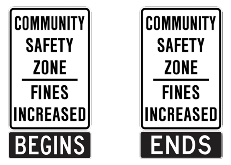
Community safety zone signs are installed to indicate to motorists they are in a designated area where vulnerable road users are likely to be present and penalties for traffic violations are increased.
Community safety zone locations
Halton Region has designated 20 community safety zones. The designation only takes effect after all the required signs are installed.
- Dundas Street (Regional Road 5) from east of Berwick Drive / Rotary Way to west of Millcroft Park Drive / Cornerstone Drive
- Upper Middle Road (Regional Road 38) from east of Deer Run Avenue to east of Itabashi Way / Country Club Road
- Upper Middle Road (Regional Road 38) from east of Broadleaf Crescent / Imperial Way to east of Deer Place
- Brant Street (Regional Road 18) from north of Ester Drive / Amherst Heights Drive to south of Hazelton Boulevard / Greenbank Trail
- Guelph Line (Regional Road 1) from north of Centennial Drive to south of Pinemeadow Drive / Mountain Grove Avenue
- Guelph Line (Regional Road 1) from south of Britannia Road to south of 8 Side Road
- Dundas Street (Regional Road 5) from west of Postmaster Drive to east of Third Line
- Upper Middle Road (Regional Road 38) from west of Deer Park Road to east of Fourth Line / Nottinghill Gate
- Upper Middle Road (Regional Road 38) from west of Sixth Line to east of Canada Court
- Upper Middle Road (Regional Road 38) from west of Ford Drive / Ninth Line (Regional Road 9) to east of QEW Off-Ramp
- Bronte Road (Regional Road 25) from south of Highvalley Road / Pine Glen Road to south of Dundas Street (Regional Road 5)
- Neyagawa Boulevard (Regional Road 4) from south of Munns Avenue to north of River Heights Gate
- Neyagawa Boulevard (Regional Road 4) from south of Dundas Street (Regional Road 5) to north of North Park Boulevard
- Trafalgar Road (Regional Road 3) from south of McCraney Street / White Oaks Boulevard to north of Sheridan College Drive / White Oaks Boulevard
- Ford Drive (Regional Road 13) from south of Sheridan Garden Drive to north of Ford Entrance
- Ninth Line (Regional Road 13) from Upper Middle Road (Regional Road 38) to 500m north of Upper Middle Road (Regional Road 38)
- Derry Road (Regional Road 7) from west of Bronte Street to west of Trudeau Drive
- Guelph Line (Regional Road 1) from south of 15 Side Road to north of Cameron Drive
- Trafalgar Road (Regional Road 3) from south of 5 Side Road to north of 5 Side Road
- Trafalgar Road (Regional Road 3) from south of 15 Side Road to north of Stewarttown Road
Road Safety Action Plan
Halton Region's Comprehensive Road Safety Action Plan (CROSAP) (PDF file) guides regional road safety management.
CROSAP uses 3 approaches to improve safety:
- engineering
- education
- enforcement
Distracted driving
It is against the law to talk, text or type using handheld communication/entertainment devices and certain display screens while driving in Ontario.
While you are driving, including when stopped in traffic or at a red light, it is illegal to:
- use a phone or other hand-held wireless communication device to text or call – you can only touch a device to call 911 in an emergency
- use a hand-held electronic entertainment device, such as a tablet or portable gaming console
- view display screens unrelated to driving, such as watching a video
- program a GPS device, except by voice commands
Other actions such as adjusting music, grooming, eating or drinking or even reaching for something are not part of Ontario’s distracted driving law. However, doing any of these activities can still result in you being charged with careless or dangerous driving. Any activity that interferes with your ability to focus on the road should be considered a distraction.
Hands-free devices only: it’s the law
The law permits the use of a hands-free wireless communication device that is firmly attached to the vehicle and controlled by voice only. You are allowed to use the device with Bluetooth, an earpiece or headset.
For more about hands-free devices and Ontario’s distracted driving law, visit Ontario’s distracted driving webpage (external link).
Distracted driving - Quick facts
- Distracted driving injures a person every 30 minutes in Ontario.
- Distracted driving kills – more Canadians die as a result of distracted driving than impaired driving, speeding and not wearing a seatbelt.
- Distracted driving is most often a major conviction which can seriously affect your insurance policy and premiums. For information about fines and penalties, visit Ontario’s distracted driving webpage (external link).
- Texting while driving makes you 23 times more likely to be involved in a crash or near-crash event compared with non-distracted drivers.
Tips to avoid distracted driving
When you are driving, you should remain focused on the road at all times—everything else can wait. Before you begin driving, remember to:
- turn off or silence your phone.
- put your phone away.
- turn on the Do Not Disturb While Driving feature on your phone or use one of the many downloadable apps that can block incoming calls and texts or send automatic replies to people trying to call or text you.
- set your GPS, music and climate control.
To keep your focus on driving safely:
- pull off the road and park the car in a safe area if you must do anything that takes your eyes off the road, your hands off the wheel or your mind away from your driving.
- ask a passenger to assist you in answering a call or text.
Be a road safety champion.
- Talk about distracted driving with your family.
- Model good driving behaviours.
- As a passenger, help the driver make good choices.
Impaired driving
Impaired driving occurs when driver ability is affected by alcohol or drugs. It is a crime and a major community safety issue.
Impaired drivers could:
- Lose their licence
- Get a fine
- Spend time in jail
- Kill or injure someone, even themselves
Have a back-up plan in place
Talk to your family and friends about impaired driving and the choices available when one should not drive.